Seki Onsen Ski Resort Map
関温泉スキー場
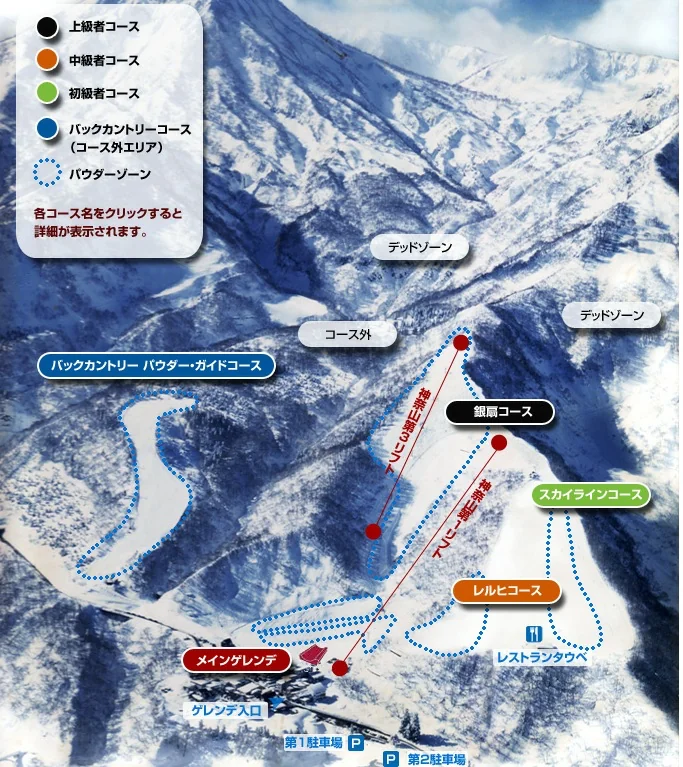
Every named run at Seki Onsen Ski Resort is traced on satellite imagery and colour-coded by difficulty: 1 beginner, 2 intermediate and 2 advanced courses spread across 310 m of vertical. Tilt the map into 3D to read how steep a line is before you commit to it: the steepest face measured here drops at 37.2°. You can switch to the resort's own trail map at any time using the toggle above the map.
Loading 3D map…
Beginner
Intermediate
Advanced
Expert
Lift
How steeply each run descends
Flat < 2° Steep 16°+
Climbs
This resort's elevation survey is too coarse to measure gradient.
Steepest pitch on each run
- < 15°
- 15–20°
- 20–25°
- 25–30°
- 30°+
Slope Data
| Code | Name | Difficulty | Length | Drop | Avg Slope | Max Slope | Aspect | Surface | Videos |
|---|---|---|---|---|---|---|---|---|---|
| SC | Skyline Course | Beginner | 559 m | 118 m | 11.8° | 14.7° | E | — | ▶ 5 |
| LC | Lerch Course | Intermediate | 374 m | 113 m | 16.1° | 19.2° | E | powder | ▶ 3 |
| MG | Main Gelände | Intermediate | 557 m | 68 m | 7.3° | 16.3° | S | — | ▶ 2 |
| BP | Backcountry Powder Guide Course | Advanced | 1031 m | 278 m | 15.7° | 37.2° | E | powder | |
| GC | Ginsen Course | Advanced | 534 m | 235 m | 25.7° | 32.1° | E | powder |